|
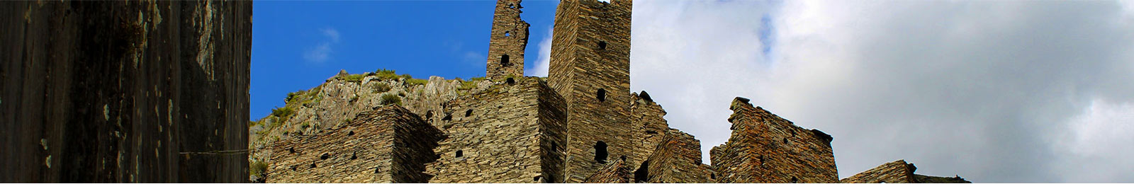
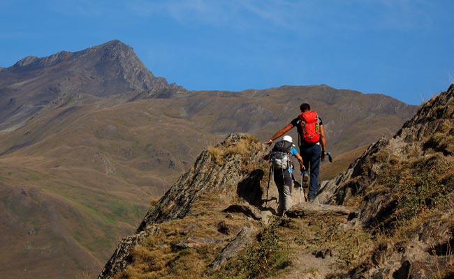
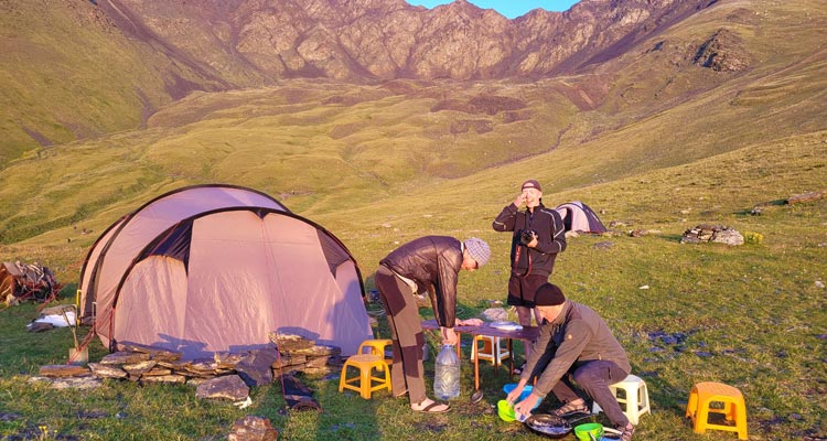
Mutso in Khevsureti Mutso in the Khevsureti region is a medieval fortified village built on steep cliffs, with defence towers, fortified houses, a cemetery and a small pagan Christian prayer house. The houses in Mutso are built in a difficult to access area and are so integrated into the landscape that you can hardly see them as you walk by. The village was abandoned for a long time, but in recent years it has been restored and the inhabitants are slowly returning. General information Region: Khevsureti The name The exact origin of the name Mutso is disputed. There are villages with similar names in Chechnya and it is thought that the name may be of North Caucasian origin. There are also theories that some villages in the region were founded by French knights, for example, who passed through Georgia during the Crusades and stayed in the country: Shatili (Chateau), Mutso (Maison), etc., but these are all theories based on oral tradition. In any case, the spelling of the village is different, it is written both as Mutso and Muzo. Historical overview The village of Mutso is one of the oldest settlements in the region. The first Turks settled here in the 10th-13th centuries, but people lived here thousands of years ago, as early as the Bronze Age. The main function of the village was to defend the border crossings from the North Caucasus or the neighbouring region of Tusheti, as well as the general control of the road. For these tasks, the inhabitants of the village were paid by the Georgian kings, they were also directly subordinated to the king, there were no princes, grand princes etc. in between. The inhabitants had additional income from animal husbandry, but due to the nature of the landscape, animal husbandry or agriculture was limited in Mutso and the region in general. The village itself is relatively small and the population has never exceeded 150 to 200 people. The village was considered impregnable for several centuries until 1769, when numerous troops from Dagestan raided and looted the village. The next major attack on Mutso took place in 1820. This time the troops of Imam Shamil, again from Dagestan, invaded and managed to take the village after a siege lasting several days. In the following decades, after all the North Caucasian republics had become part of Tsarist Russia, peace and quiet returned to the Great Caucasus. The people of Mutso also began to leave the towers and steep slopes and build houses by the river. By the mid-19th century, the towers were barely inhabited, but new settlements under the towers continued for a good hundred years. Mutso in the Soviet era In the 50s of the 20th century, the Soviet regime started the "planned resettlement" to settle the free, uncultivated areas of the country. Many villages in the Great Caucasus were abandoned, and Mutso was no exception. Before the forced resettlement began, the village was home to around 150 people. Mutso in the present It was not until the beginning of 2000 that the first family, descendants of the old village inhabitants, returned to Mutso and they still live in the lower part of the historic village. In 2014, a reconstruction project for Mutso was approved and after 5 years of work, the village was rebuilt in the old style. In the meantime, other families have returned to Mutso and in the summer there are 4 or 5 families living there, but in the winter most of them go back to the valley. The architecture Mutso is situated between 1800 and 1900 metres above sea level and consists of about 20 fortified houses and six fortified or watchtowers. The historic settlement consists of three parts. The first, the northernmost, is located at the highest point of the settlement on a relatively flat terrain and consists of defence towers and a prayer house typical of the region. The other two parts are terraced to the south. In this area there are fortified houses and a high fortified tower. The village is protected from the east and west by steep slopes. Fortified towers Only three of the six fortified towers remain. One is at the northernmost point of the village and was the most important tower for the settlement, as danger usually came from the north. The second, called "Torghva's Tower" after the national hero Torghva Dzagani, stands in the north-western part on a steep slope above the river. The third tower stands between the houses in the southern part and is called "Cholokha's Tower" because of its crooked shape. The defence towers are made of shale, are 11 to 13 metres high and have 4 to 5 floors. The entrance is built at a height of about 2.5 metres and there are embrasures on each floor. The towers do not have a pyramidal roof, as is common in the region, but a crenelated one, and the buildings themselves are square in shape. Fortified houses In the village there are about 20 fortified houses built of shale, with 3 or 4 floors. The first floor was used for cows, the second for sheep (only in winter), the third for living and the fourth for storage and defence. The roofs of the houses are flat, so that in an emergency you could walk over the weirs and get to the house that needed the most help. Death houses and regional prayer house Just below the fortified houses, there are two small slate houses, about 2 x 3 metres, which were used for centuries in times of plague or other contagious diseases. The seriously ill would go there to avoid infecting others and wait for death. Many human bones can still be seen inside the houses. Regional Prayer House The 2 x 4 prayer house named after St George is located in the northern part of the village on flat ground. It is built of shale and has a pyramidal roof. Religious rituals were performed in the prayer house, but it was also a place where people met to discuss and make decisions about important village issues. School, health care, accommodation, etc. There is no school or kindergarten in the village, but children from Mutso or nearby settlements are taken to Shatili, 12 km away, where they are cared for in a children's home during the week and brought back to the villages at weekends. Medical care is also only available in Shatili There are no proper hotels in Mutso, but families who spend the summer in the village offer rooms with breakfast and dinner. There is a pub at the entrance to the village that serves a small selection of food and alcoholic drinks. The pub also has a small shop. Transport and road to Mutso Public transport is only available to Shatili and only twice a week. From Shatili to Mutso you have to walk the 12 kilometres or hitchhike. The road from Shatili to Mutso is being upgraded from 2018 and will soon be accessible to cars without four-wheel drive. Camping and hiking in Mutso There is little choice for camping in Mutso, but if you must, there are campsites just before Mutso (coming from Tusheti), just below the road by the river. If you want to walk from Mutso to Shatili, you will also have to take the dusty road, as there is no good track to Shatili. Otherwise, there are no day walks from Mutso, but the village is on the popular Omalo to Shatili trail and every walker has to pass through Mutso. On following trip, you will visit Mutso
Trekking Omalo to Stepantsminda >> from 1.850 EUR |
 |
 |
 |
 |